
This is the first of four image accounts covering three days of storm action across N. Ireland between June 13th and 15th 2009. Since I have taken hundreds of images over this period and have more to sort through I'm going to keep this as short as possible. I knew a week in advance there was a high probability of storms as the CAPE and LI charts showed consistent readings every day leading up to the main event. Very often the models get downgraded closer to storm time but this was one of those rare times that not only came true, but even exceeded what had been expected. Saturday June 13th was the first day of action with thunderstorms expected over a wide region across Ireland, however N. Ireland was the place to be with CAPE values between 700 and 1000 depending on where you lived with a lifted index between between -2 and -4. With a moist SWly flow and strong solar heating storms were expected to break out from the afternoon until after sunset.
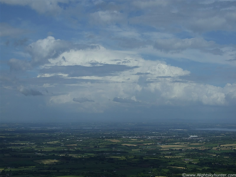
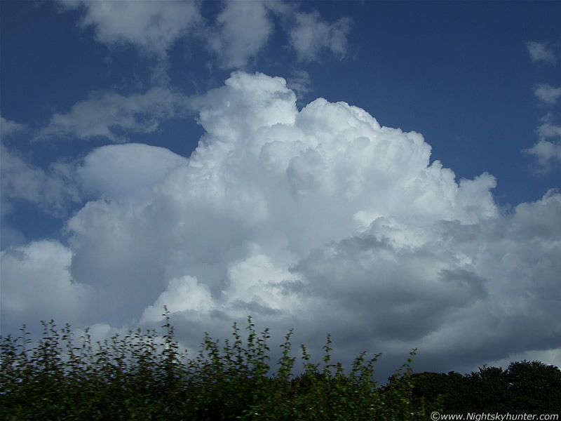
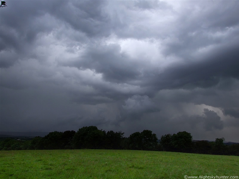
Normally you can tell by looking at the sky during mid day if the chances are good based on the convection visible in the sky. It was evident to me at the time that the convection present over Maghera was among the very finest I have ever seen since I got interested in this subject. The sheer size and power of the solid updraughts and cells were stunning to say the least. The atmosphere was so unstable that showers began to break out faster than the radar could detect. There was so such dynamic motion that I was expecting a storm at any moment. During the early afternoon a cluster of impressive updraughts arrived over Slieve Gallion and began to organize with flanking line at the rear with anvil. Soon after, intense rainfall began to form and the sky darkened, it was then that I heard the first loud rumble of thunder of the day which was very evident even from indoors. I grabbed the camera and went up the road for a better look. I could see the large storm beyond the rooftops of Crewe Drive over the E section of Maghera. I was impressed by how dark and nasty it looked, the rain falling from its core was torrential.
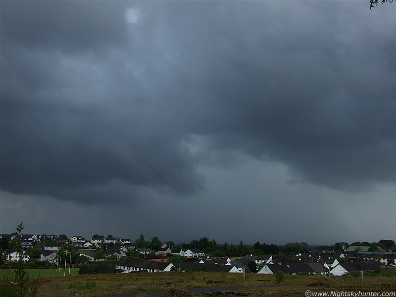 |
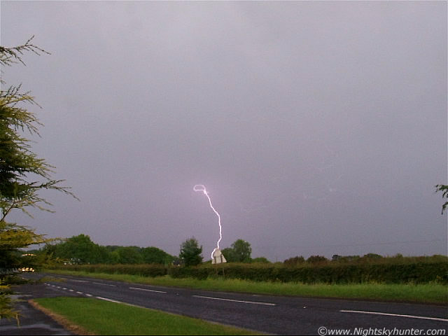
I found a location on high ground and mounted the camera on the tripod and began to take images while at the same time trying to keep the lens from getting splattered by raindrops which were now falling on me from another cell approaching from the W. The image above shows just one section of the large storm which was moving from R to L very slowly. The precip was very dense with a silver colour but I also noticed a subtle green tinge indicating the presence of hail. Despite it being very wet here I was glad the precip core was in the distance, that way I actually could see the storm structure with some decent visibility. Loud rumbles of thunder were booming away here when I took this image. A gorgeous blue coloured c-g bolt hit the ground where the precip was falling so I began to take video while periodically switching back to stills. There was plenty of motion going on in those clouds so I was watching very carefully incase something suddenly wrapped up. This image was used on the BBC News Line television weather forecast on Monday incase any local readers think it looks familiar. Facing SE.
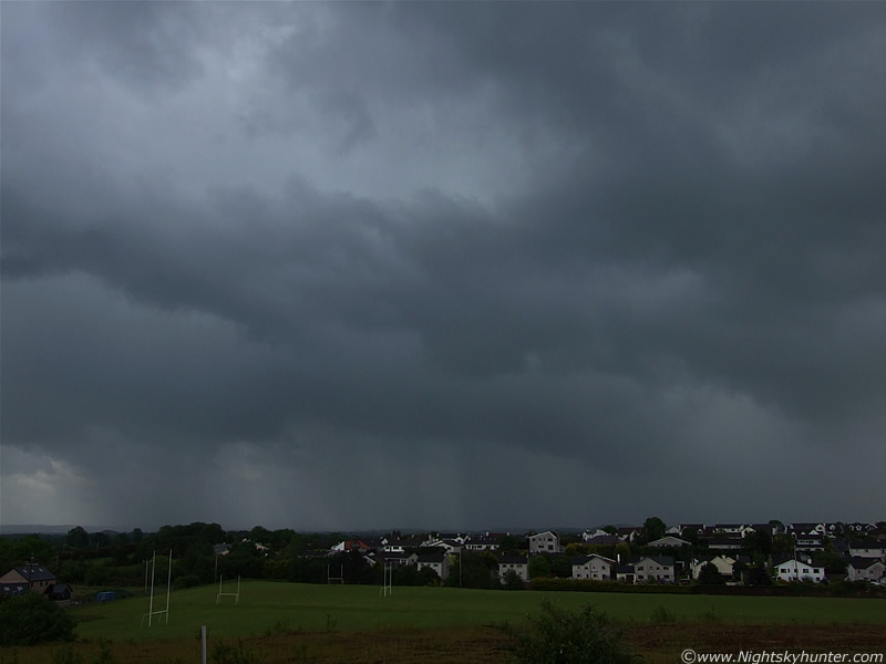 |
Now looking E as the storm crossed the sky, I seen a decent number of rapid fire blue I-c and c-g bolts going down behind those houses among the rain. The power in my house was knocked off at this time. The thunder from this really got my heart pounding I can tell you. It was a nice storm.
 |
Now looking to the NE a little later at the rear of the storm from a better elevated position. That big chunk of cloud is the updraught/inflow region of the storm. The complete updraught was huge, so this is just the bottom section. There was nice structure to it.
 |
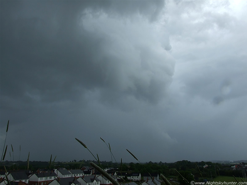
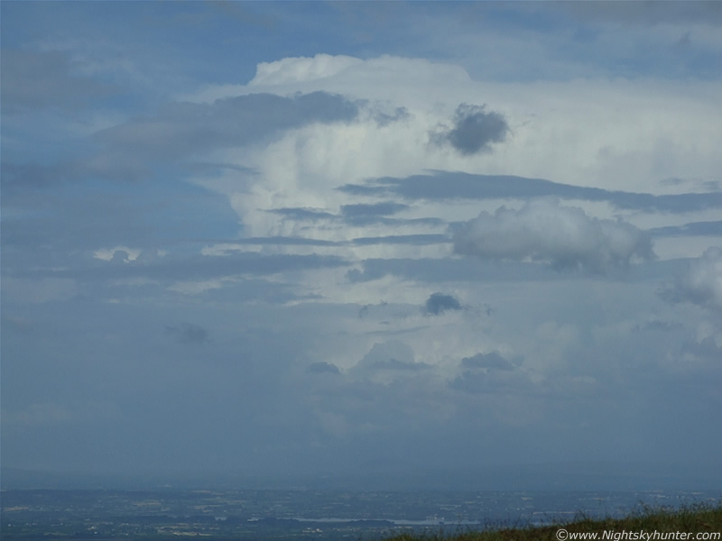
This is another cell moving in from the W. Looking NW. This was massive, the image above shows part of the updraught and flanking line at the rear. The inflow was amazing to watch, all those patches of grey cloud where describing amazing motions as the cell sucked them into the base. An entire cluster of cloud was being pulled straight overhead into the cell at high speed. I honestly thought a vortex was going to form. The anvil was rock solid and reaching, what I later learned, was a height of 32,000ft!.
The storm continued to rumble away as it drifted further into the NE. I was delighted to have seen my first storm so early in the day, so anything else after this would be a bonus. Meanwhile the air was getting even more unstable and the temp even hotter. The greatest CAPE values would occur after 19.00 in the evening so there was plenty more to come. So, we decided to go storm chasing, this was blind chasing because I had no access to the net on the road so couldn't see the radar but that wasn't a problem, we would just have to do this the old fashioned way by visual observation. Heading out of Maghera and onto the country roads it was pretty easy to get a good view of the entire sky. I was able to watch all the convective updraughts and decided on which ones to follow. Looking back to distant Maghera I seen a monster cell over the Sperrins with absolutely incredible updraughts exploding up from the back. It was too far away to chase, and no doubt was probably a storm over the barren country somewhere. I had my eye on new and impressive convection going up to the S and SW with the towers showing evidence of wind shear, so once we reached the junction at Tobermore I decided that those S and SW towers were the ones to get near. This would soon prove to be a good decision.
 |
Since this was going to be a long day we stopped in Draperstown to get some snacks. The girl working at the till on the local shop commented on what a great hit day it was, when we told her there was thunder and lightning at Maghera she seemed genuinely shocked. Back out in the street I hung around the car for a while studying the sky. I knew by looking at the clouds that a storm would arrive over here, or at least near here, at some stage in the day, the local mountains which surround the place would enhance any storms for sure. It always amazes me how little people know about the sky, and the few which did thought it was a fine Summer's day. Not one of them knew by looking at the convective clouds that there could be a trouble ahead. This shot was taken while leaning on the hot roof of the car showing evidence of wind shear in the atmosphere above the town. This would later come in handy for storm organization and longevity. The view behind me was semi-obstructed by buildings, tall trees, and a Church, however within the gaps I could see stunning updraughts exploding up with a good quality base. I knew by looking at these that the chance of getting a funnel cloud today was very high indeed.
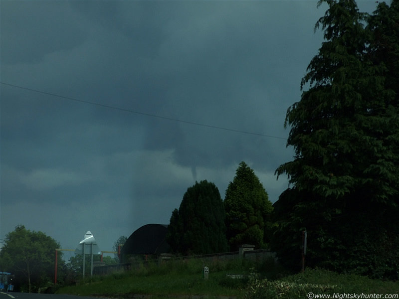 |
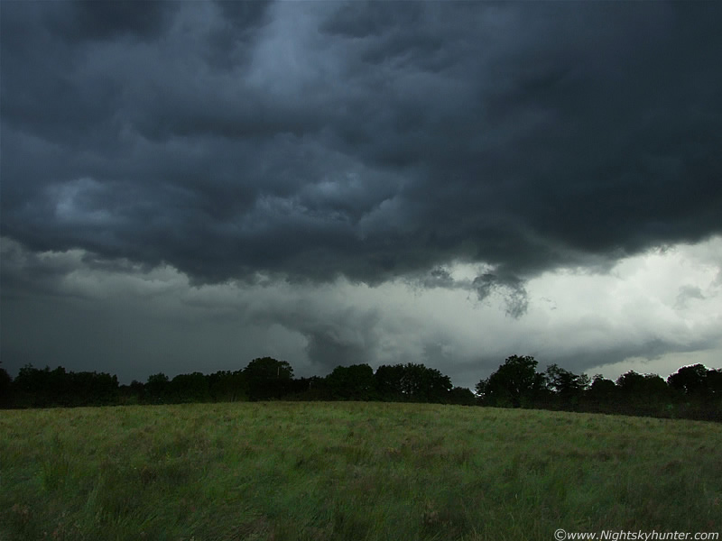
The choice was up to me, where did I want to go?. I needed a clear view of the horizon in all directions so a high location was what I needed, so I decided that we should head to the very top of Slieve Gallion. We get back in the car and just enter the outskirts of Draperstown when the sky suddenly reveals itself through a gap in the trees which line the road sides...and there, in plain sight, was a really good funnel!. It was extremely elevated and unlikely to have touched down at all but it was a good one. It had dropped from the base of a towering cu/updraught and was almost black in colour and hanging straight down below the central tower sporting the classic tubular shape. It was actually more like a cylinder or pipe. You won't be able to appreciate this from the images, but this was extremely eye catching, it would have been the first thing to attract your eyes if you even glanced in that direction. I'm certain it was visible from a very wide area!. It could have been even lower before I spotted it but since no other reports have arrived in I will never know for sure. So far, we are the only people who seen it.
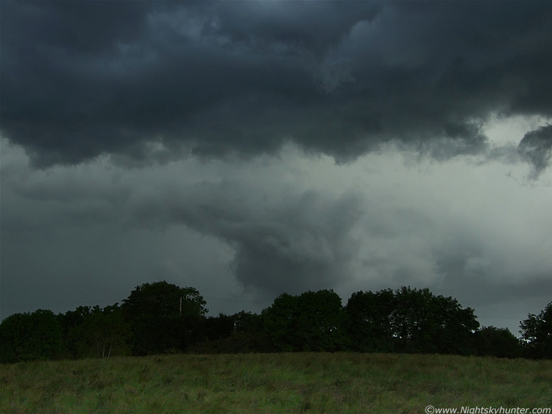
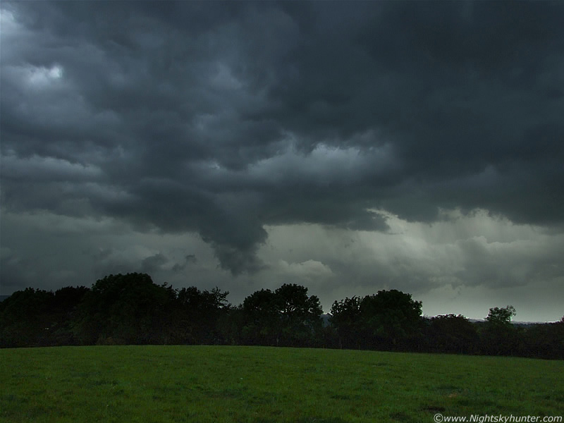
Getting images though was a major problem. We were driving swiftly along narrow country roads surrounded by trees and hedgerows which kept blocking the funnel from view. It was like...see it...don't...see it...don't...and so on, so it was only when we had a brief clearance in the trees did we get a good view of it. The car was rising over hills, dropping into dips, and turning wildly has we navigated through the country roads at the flank of the Mountain. Trying to take images with the car jumping up and down like this was a nightmare, at one time a pot hole shook my internal organs around inside me, then a crest on the road made by head and camera bump against the roof, you know what it's like. Despite all this I managed to get about 10 images, all of them taken through the front windscreen of the car.
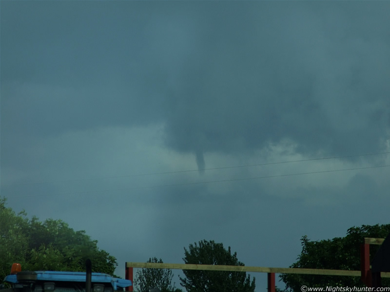 |
Here's a few more. This was the third funnel cloud I have seen this year so things are looking good. You can see the large collar of cloud from which the funnel was hanging from. The tower itself extends way above the frame. You can see the cab of an approaching tractor to the lower L. I wonder what he was thinking when he looked in the window and saw me pointing the camera frantically up at the sky with bulging eyes.
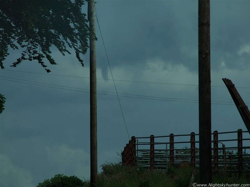 |
The funnel began to bend a little then eventually weakened and died. It only lasted a few min's but I was very happy to have seen it. This was around 14.47 BST. I was thinking at the time that this day was a success already, that's a storm and a funnel and the day was young yet.
After a considerable drive we made it to the top of Slieve Gallion. The view from there was spectacular and perfect for storm spotting. It was very sunny and extremely warm and humid. We decided to have a picnic. It was great sitting out there in the heat eating tasty lunch with a warm brew on top of the world while stunning convective cells passed by one after the other the entire time. Each one of them looked capable of producing another funnel, that's how good they were.
 |
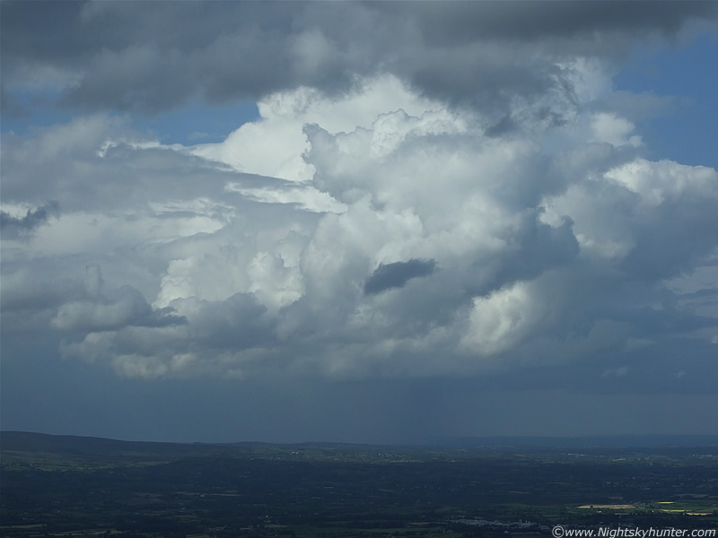
After this I walked over a hill, looked to the SE, and saw this. A stunning cell was visible miles away in that direction, it was located over the E side of NW Lough Neagh. Here it is moving R to L. The upper part of the Lough can be seen to the far R with another section below the cell. The cell itself was like a huge rock-solid mountain with a flanking line extending for miles to the S. At the rear you can see new updraughts exploding up, and on the leading edge was a clear gust front/shelf cloud. This looked like a very powerful cell and was most likely a storm. It developed an overshooting top in the form of a large persistent white dome on top which you can just about make out on this image. The sky was very hazy below the cell so it was difficult to spot lightning or a funnel from that distance. I took about 50 images of this one scene alone but they didn't turn out very well thanks to sunlight visible in the viewfinder and LCD screen. I got a record of it anyway. This was around 15.30 BST onwards.
 |
This is a zoomed shot of the front section of this cell. For a sense of scale look at the land and houses below and compare to the girth and height of this cell - amazing.
 |
We hiked around the mountain for a while and climbed to its very top which is marked by a tall pile of rocks. It brought back memories of watching good storms from here in 2007 with Conor McDonald. Visible miles away to the NW was thunderstorm number two. I'm not certain exactly where it was located but it seemed not too far away from Maghera again. This is a zoomed shot looking at the very back of the cell as it moved into the distance. Heavy curtains of precip broke out and within that area could be seen blue c-g lightning followed by distance rumbles of thunder. It was a surreal scene to be sitting under hot sunshine with Buzzards calling, Butterflies fluttering around you, while thunder boomed at the same time. On the image you can just see a section of the anvil, the rest of it extends up behind that mid level cloud and high up into the atmosphere out of the frame. Note the dark lowering under the cell to the ROH behind the rain. It was too far away to notice rotation but I suspect that actually could be another funnel.
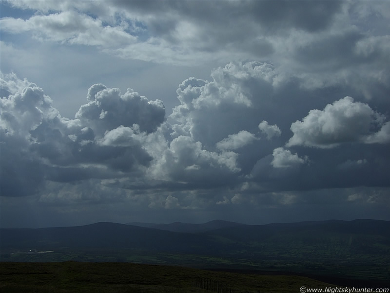 |
Here's another line of convection over the mountains. It was a little dark to the SW but the view was poor and I suspected something might have been approaching but I couldn't be certain. In the S it was blue sky and convection so we decided to drive back down the mountain again to lower ground since it was approaching evening time.
 |
There was some really powerful convective updraughts going up again in spectacular fashion like this guy. I screwed down the window and took this snap from the moving car. The heat was getting intense now and we were fast approaching the period of greatest instability.
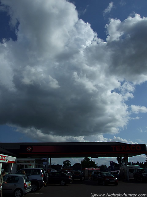 |
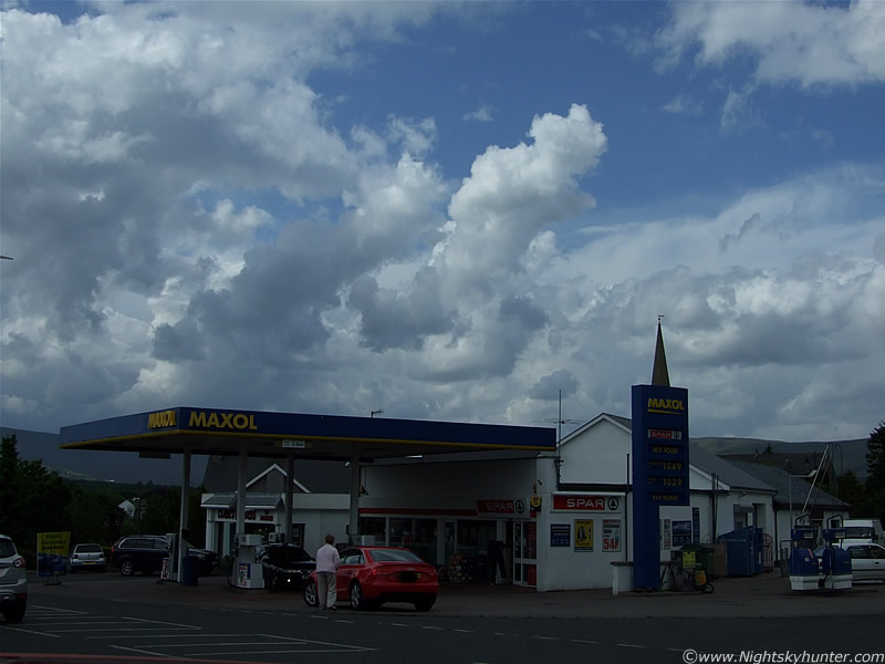
Back on ground level we stopped at this filling station in Moneymore to get a well deserved ice cream. I felt something crawling inside by shirt but put it down to my imagination, then I felt it again, then I heard a buzzing sound, it was Wasp crawling up my chest. I completely freaked out and started ripping at my shirt so I could expose it to the air and the Wasp got more angry in the process. I was just waiting on a nasty sting, I started flapping my arms around like crazy trying to slap my shirt to encourage it to get out. It crawled up my back then emerged from my collar at the base of my neck, it was a horrible sensation. Amazingly it didn't sting and just flew away out the car window. I then just realized there was a car parked side-on to me and the female passenger was staring at me, I thought it was so funny because she didn't see the Wasp, what she saw was me flapping about like a complete nutter then going calm again for no reason. I burst out laughing at the thoughts going through her head. We then began the drive home.
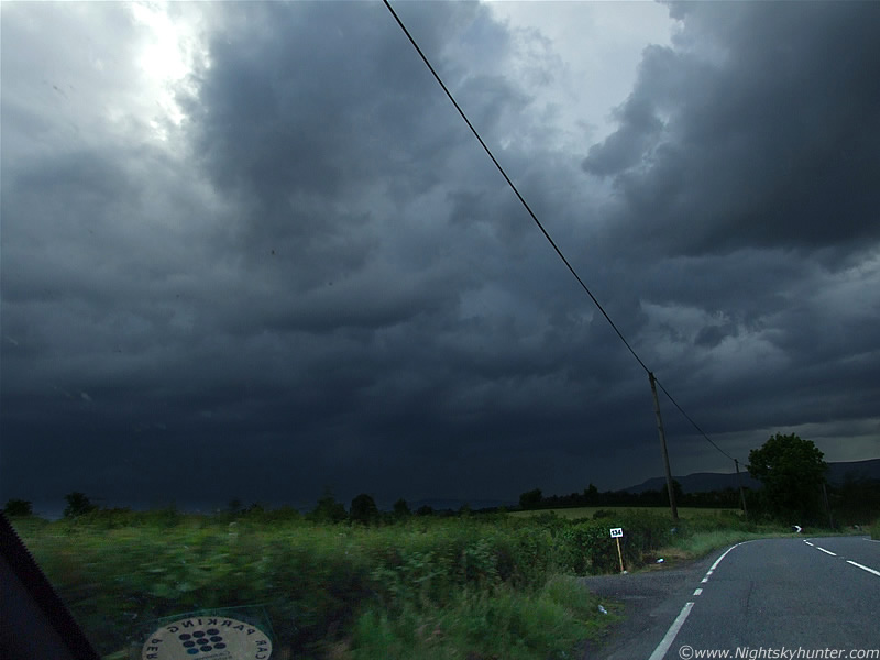 |
On the road between Moneymore and Tobermore was when we saw thunderstorm number three of the day, and this one had nasty wrote all over it. This was snapped through the front windscreen again, the image doesn't do the sight justice I can tell you, the entire W to SW sky was pure black, an absolute evil sight. It approached over Slieve Gallion where we had been based not too long ago and was moving to the NE. It was just a huge dark mass of cloud with torrential rain from it, and it was heading for Maghera, my home. On the drive home I watched it approach over the Sperrin Mountains, at this stage I seen no lightning but I was certain there would be very soon. We got to Maghera just ahead of it and I went back out again, this time on foot, to watch it come in.
 |
This image was captured from the entrance to The Gynn's looking N at the leading edge of this dark mass. That's a huge shelf cloud which passed overhead very rapidly. It was solid like a concrete slab and stretched across much of the sky. It was quite impressive looking with some sunlight filtering through casting a subtle orange glow to sections of the underside of the shelf. I then went out to a good local location, but before I got there I heard the first angry rumble of thunder.
 |
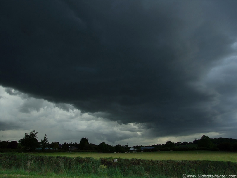
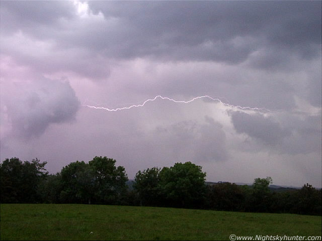
This was the structure behind the shelf. It was a mess of bizarre structure and outflow cloud. Heavy precip was falling over the mountains and getting closer. A complex loop of pink lightning flashed in there followed by a spine chilling rumble, soon after, another one, then a pink c-g with I-c bolts piercing out from the clouds on either side at the same time, my heart began to quicken and I really began to get worried.
 |
Closer in on the same scene. The gap between lightning and thunder was decreasing fast, the storm would soon be upon me.
 |
I was either brave or stupid for being out here with lightning in such close proximity. The first drops of rain where falling now and the lens was getting wet.
 |
A lot of bolts where hitting over the hills where the precip was falling.
 |
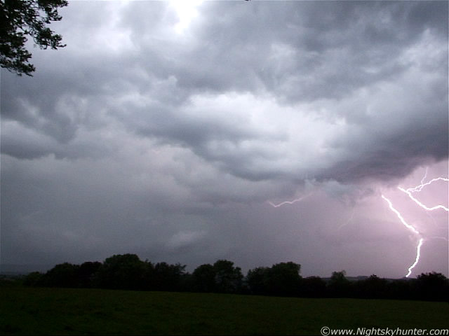
It was around this time that all hell broke loose. The storm became the most electrically active light show I have seen during the last few years. Torrential rain mixed with hail began and with it was almost continuous lightning in the form of multiple I-c and c-g bolts, these were extremely nasty and unpredictable, with bolts all clustered together in groups which simultaneously hit the ground and flickered through the sky in crazy zigzag lines and loops while illuminating the rain a vivid pink colour with each flash. The thunder changed from rumbles to loud cracks which echoed for a long time through the atmosphere. It was a dangerous and frightening storm!.
 |
Video still of an I-c bolt.
 |
Another still. Lucky to catch this one at the edge of the frame. Several c-gs and a single I-c on the L. I had to take cover in a ditch under a small forest while at the same time praying I wasn't struck. It was at this point in time I had an experience which I will never forget. There was a Sheep standing beside me no more than 100 yards away to my L within the same field. There was a bright flash of lightning overhead so I instinctively ducked and took cover. I looked back again and got a shock, that Sheep was still there, but this time it was laying stone dead in the field. It must have been killed in an instant by lightning!!!. It was a horrible sight which disturbed me, I felt sorry for the Sheep but at the same time I knew that just as easily could have been me, so feeling shaken I ran quickly to lower ground and began the walk back home while the storm continued dropping c-gs for well over an hour.
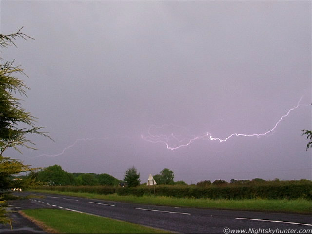 |
I stopped on the W side of the Coleraine Road and took some video hoping for one last catch of lightning. I caught a good one. Within about one sec or so I seen at least 4 I-c bolts flicker across the sky then ending with a 5th which was a pink c-g which seemed to strobe several times before vanishing. The above is one of those.
 |
Here's the c-g from the same set.
I watched it for a little while longer then walked home through the water logged footpaths and back home. I was completely soaked and needed to change. My camera got damp and stopped working which required a night in the hot press to dry out, it now works perfectly. I had time to eat some late dinner and even then I could still hear the storm rumbling away in the NE for a long time with a very tall precip core at the rear. Some mammatus could be seen on the back of the anvil too.
I found out that the power went out again in our house, and so did the power in main street Maghera. In fact, according to the NI electricity board 12,000 homes were out of power thanks to this storm. I don't think anyone in the area will forget this one in a hurry. A friend informed that the rooms inside his house were lighting up from each flash of lightning. I checked the radar, the storm was a huge cluster of red and white echoes, the sferics charts showed so many lightning strikes that the entire W side of Ireland was red on the chart. What a show!, however it didn't end there, storms continued to grace the sky for the next two days, and I was ready for them. More to come. Thanks for reading.
Martin McKenna